3D ground seismic survey planning
 Instant download
after payment (24/7)
 Wide range of formats
(for all gadgets)
 Full book
(including for Apple and Android)
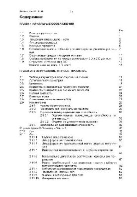
The book Planning for 3D Terrestrial Seismic Surveys, written by a team of authors led by Cordsen, is a unique publication that immerses the reader in the world of geophysics and seismology. This publication will become an indispensable assistant for specialists in the field of geological exploration, as well as for students and teachers interested in modern methods of studying the earth's crust. The book focuses on the methods and technologies used to plan terrestrial seismic surveys in three-dimensional format. This is an important topic as high-quality seismic studies play a key role in mineral prospecting and exploration, as well as in geological risk assessment. The authors consider in detail various aspects, ranging from the choice of equipment and ending with the analysis of the received data. They share experiences that will help avoid common mistakes and optimize the shooting process. The book is intended for a wide audience: from undergraduate and graduate students studying geophysics, to experienced professionals working in the oil and gas industry or engaged in environmental research. If you are interested in seismology, geophysics or just want to expand your knowledge of modern methods of Earth exploration, this publication will be a real find for you. It will be useful both for those who are just beginning their journey in this field, and for those who already have experience, but want to update their knowledge about the latest technologies. The topics raised in the book cover a wide range of issues. The authors discuss not only technical aspects, but also strategic approaches to seismic survey planning. They emphasize the importance of integrating different data and methods, allowing for a more complete understanding of geological structure and conditions. The book also addresses environmental and safety issues, which makes it particularly relevant in light of the current challenges related to sustainable development and environmental protection. The style of writing of the authors is clear and accessible, which makes complex concepts understandable even for non-professionals. They use a lot of examples and illustrations, which helps the reader to better absorb the material .. In addition, the book contains practical recommendations that can be immediately applied in the work .. This makes 3D Land Seismic Survey Planning not only a theoretical but also a practical tool. Kordsen and his team are authors known for their research in seismology and geophysics. Their previous works have received recognition in scientific circles, and this publication was no exception. It continues the tradition of high-quality scientific literature, offering readers up-to-date and time-tested knowledge. If you’re looking for books on geophysics, seismology, or Earth exploration techniques, 3D Terrestrial Seismic Survey Planning will be a great addition to your library. This publication will not only expand your knowledge, but also inspire new ideas and projects in your professional activities. Do not miss the opportunity to immerse yourself in the exciting world of science and technology that shape our understanding of the planet on which we live.
LF/557878441/R
Data sheet
- Name of the Author
- Кордсен
и др. - Language
- Russian


